

The Bureaucratic Bermuda Triangle: A Maritime Guide to Navigating the Great Lakes Border War
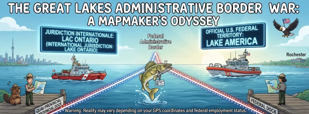
Attention all recreational anglers, weekend sailors, and anyone currently drifting in a fibreglass vessel somewhere between Rochester, New York, and Toronto, Ontario. Please secure your life vests and prepare to enter a state of total administrative vertigo.
As you may have heard, the United States federal government recently engaged in a daring, bloodless coup against a body of water. By the power vested in a digital spreadsheet, the southern half of a 19,000-square-kilometre international waterway has been officially scrubbed of its Canadian linguistic contamination. It is no longer Lake Ontario. It is Lake America.
But only if you ask a U.S. federal employee.
If you ask the Canadian government, it is still Lake Ontario. If you ask the state government of New York, it is still Lake Ontario. If you ask the local wildlife, they will likely blink at you with the profound indifference inherent to largemouth bass.
What this means for the average boater is that the international border is no longer just a line on a map separating two friendly nations. It is now a conceptual tear in the fabric of space-time, a linguistic fault line where reality itself depends entirely on which direction your bow is pointing and which bureaucrat is tracking your GPS coordinates.
Imagine, if you will, a beautiful Saturday morning out on the water. You are sitting in a pontoon boat, enjoying a thermos of coffee, completely unaware that you are floating directly in the middle of a geopolitical comedy sketch.
To help you survive the upcoming boating season, we have compiled a brief survival guide for navigating this new, highly patriotic watery labyrinth:
- The Dual-Compass Protocol
Under the new regulations, every vessel operating in the area must be equipped with two entirely separate navigation systems.
The first system, to be used while heading north, will display standard geographic names established by centuries of maritime history.
The second system, which must be switched on the exact millisecond you turn south toward the American shore, will automatically activate “Freedom Mode”. On this screen, all Canadian references are instantly vaporised. Toronto is replaced on your map by a blank grey void labeled “The Great Foreign Beyond,” and the water beneath you is officially designated as 100% pure, certified American moisture.
Do not mix up the screens. If you accidentally reference “Lake America” while asking a Canadian Coast Guard vessel for a tow, they are legally required by their own prime minister to pretend they have no idea what body of water you are talking about. “I’m sorry, captain,” the radio operator will say with trademark northern politeness, “we only operate in reality. Please consult a map that wasn’t edited via a Microsoft Word shortcut.”
- The Rochester Pier Paradox
The true beauty of this administrative masterpiece can only be appreciated from the shoreline. Consider the logistical magic currently unfolding on the piers of upstate New York.
Because Governor Kathy Hochul has openly mutinied against the federal naming decree, New York State park rangers are still handing out pamphlets welcoming tourists to the historic shores of Lake Ontario. However, if a U.S. National Park ranger happens to be standing five feet away on federal dock property, they are legally obligated by Washington to hand you a brochure praising the majestic, unyielding waves of Lake America.
This creates a spectacular localized tear in the universe. If you stand with one foot on a state-owned boardwalk and one foot on a federal pier, you are technically stranding your body across two completely different geographical features simultaneously. Quantum physicists are reportedly rushing to the area to study how a single drop of spray can be both Canadian-adjacent and hyper-patriotic at the exact same moment.
- Interrogating the Local Fauna
The federal mandate strictly dictates that all internal documentation and data repositories must reflect the change. This has led to intense speculation regarding the status of the local fish population.
Are the salmon swimming across the international border required to clear customs? When an American trout migrates across the invisible line into Canadian waters, does it instantly lose its federal designation?
We highly advise against asking the fish for clarification. Not only are they notoriously poor at reading executive orders, but a recent survey of local walleye indicated that they remain aggressively indifferent to the trade war. They will continue to bite on Canadian nightcrawlers and American lures with equal, treasonous enthusiasm.
- The Upcoming Administrative Expansion
Why stop with the Great Lakes? Now that Washington has discovered the immense geopolitical power of the “Find and Replace” function, the future of global geography is limitless.
Insiders suggest the administration is already looking at other international bodies of water that could benefit from a severe corporate rebranding. Why should the Atlantic Ocean get to keep its historic, Euro-centric title when it could easily be renamed the “Great American East Moat”? The Pacific Ocean is practically begging to be re-entered into the federal database as “Western Lake America.”
not forget the English Channel, which could easily be updated on federal maps to “The Pre-American Shipping Corridor.” If the rest of the world refuses to update their maps, that is simply their loss. They can continue living in the physical world, while the U.S. federal government boldly sails into a digital utopia of its own making.
So, as you head out onto the waves this weekend, remember to pack your dual maps, your state permits, your federal compliance forms, and a healthy sense of the absurd. The water might look exactly the same as it did last week, but don’t let your eyes deceive you. You are swimming in a bureaucratic masterpiece.
Just try not to capsize on the border line. Splitting the difference between two entirely different national realities can be incredibly tough on a fiberglass hull.
